If you want to experience the diverse natural landscapes of the Kuril Islands, have an active time, and challenge yourself with a challenging independent hiking and climbing expedition, then this trip is for you!
Picturesque cliffs and ocean bays, hot springs, and active volcanoes—all this awaits you during your trip to Kunashir, and the icing on the cake is an ascent to the island's highest point, Mount Tyatya.
A hike that will allow you to explore not only the world around you, but also yourself, awaits!
Duration
16 days
Comfort
Group
up to 12 persons
Age
18+
Region
Kuril Islands / Russia
Trip organizers:
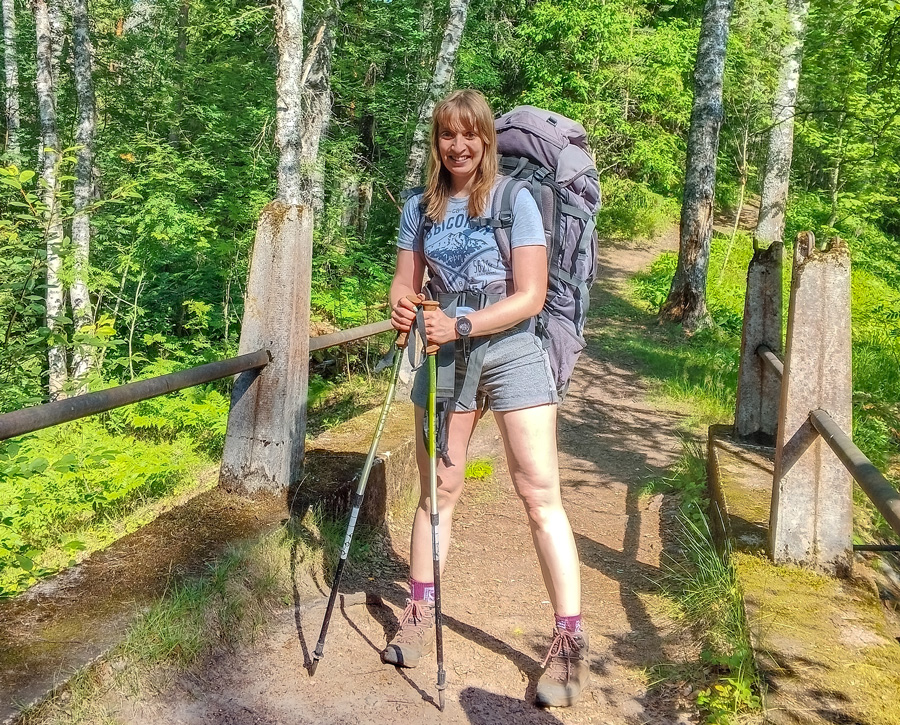
VICTORIA SHATALOVA
A professional traveler and tour organizer with 16 years of experience. She has visited 40 countries around the world and 82 regions of Russia. She has organized and participated in numerous hikes, rafting trips, car trips, and ascents, including an ascent of the highest and most dangerous volcano in Eurasia, Klyuchevskaya Sopka (4,850 m), as well as ski trips in the Northern and Subpolar Urals, the Murmansk Region, and the Kuznetsk Alatau... Read more
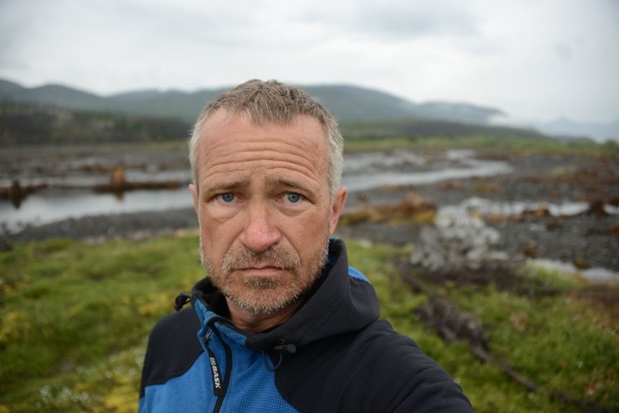
EVGENY ANDROSOV
A professional traveler, climber, mountain guide, and tour instructor with 35 years of experience. He has visited every continent, 83 country, and 72 region of Russia. He has organized hundreds of solo trips, expeditions, hikes, and ascents, and created numerous new, unique tourist routes. Read more
Itinerary day by day:
Yuzhno-Sakhalinsk
We'll meet at the Yuzhno-Sakhalinsk airport, check into a hostel, and relax. If you'd like, you can take a stroll around the city and get to know the capital of the Sakhalin Region.
Transfer to the airport and flight to Kunashir Island (Yuzhno-Kurilsk village). Upon arrival, we'll check into a hostel and explore the village. Yuzhno-Kurilsk is the largest settlement on the Kuril Islands, with a population of over 7,000, most of whom are employed in fishing and fish processing. To learn more about our surroundings, we'll visit the Yuzhno-Kurilsk Museum of Local History.
Read more
Golovnin Volcano Caldera
We'll have breakfast and head out on the first trekking route of our trip – to the Golovnin Volcano Caldera. We'll travel about 50 km by vehicle to the starting point of the trekking route. Golovnin Volcano is the oldest and southernmost volcano in the Kuril Islands; its caldera was formed by an eruption approximately 39,000 years ago. We'll reach an observation deck overlooking two mineralized lakes, Hot and Boiling. After enjoying the panoramic view, we'll descend to the lakes. You can swim in Hot Lake (it's not actually that hot). Boiling Lake truly lives up to its name. Gases and streams of boiling water emerge from cracks in the lake's bottom, and in some places the water appears to be boiling. The water temperature varies depending on the location, but swimming is dangerous—you could get scalded, so we won't risk it. We'll observe Boiling Lake from a distance. We'll see solfatara fields—areas of the caldera where thermal waters and gases vent—and climb the volcanic dome. After a snack, we'll head back, and at the end of the hike, we'll return to the hostel by transport.
The day's hike will be about 20 km without packing.
Cape Stolbchaty
Today we'll visit one of Kunashir Island's most famous landmarks – Cape Stolbchaty. The cape is a series of rocky hexagonal pillars formed by the contact of basaltic lava from the Mendeleev Volcano with the waters of the Sea of Okhotsk. Walking along the cape is challenging, as in some places the cliffs reach right down to the sea. In some places, you'll have to climb up rocks like steps, and in others, along the cliffs along the sea. Fortunately, we'll be able to do these activities without heavy backpacks. Our efforts will be worthwhile: Cape Stolbchaty is a unique geological monument, unlike many others in the world, and the beauty of the local nature is breathtaking.
Day trip: 40 km by transport, 12 km on foot without heavy packs.
Climbing Mendeleev Volcano
A challenging, yet eventful and interesting day awaits us. We'll climb the 887-meter-high Mendeleev Volcano. Our route begins along a trail through a picturesque forest, then disappears into dense bamboo thickets. After about two hours of climbing, we'll emerge into a solfatara field, humming with powerful gas emissions from the earth's interior. Then, climbing a steep slope leads us to the summit of Mendeleev Volcano, which offers stunning views. The Japanese island of Hokkaido can be seen on the horizon in the distance.
During the day, we'll cover 40 km by vehicle, 9 km on foot, and gain 700 m in elevation.
Devil's Finger Kekur - Chaika Hot Springs
Today we'll begin the independent portion of our hike, so we'll leave the hostel with sleeping bags, tents, and other necessary gear and food. The supply vehicle will take us to the starting point of the hike (approximately 20 km from Yuzhno-Kurilsk). Along the way, we'll stop to see another Kunashir landmark – the Devil's Finger Kekur, a vertical, isolated cliff rising near the shore of the Pacific Ocean.
Today's hiking route will run along the Pacific Ocean shore and will be short, about 5 km. Afterward, we'll set up camp near the Chaika Hot Springs, cook our first camping dinner, and relax with a dip in the hot springs.
Chaika Hot Springs - Tyatina River
Today we have a fairly long hike ahead of us. First, we'll walk along the Pacific Ocean shore past Cape Medved, then our trail will head inland, where we'll have to cross a small ridge and descend from it. Near Cape Rogachev, we'll return to the shore and continue along it. Along the way, we'll have to cross several knee-deep fords, and we'll spend the night near the island's largest river, the Tyatina.
Tyatina River - Cape Mysovoy - Cape Rubezhny
In the morning, we cross the Tyatina River (the ford is about knee-deep). Our route then leads along a partly rocky, partly sandy shore. There are practically no trails, and we'll occasionally have to ford streams and channels. By evening, we arrive at Cape Rubezhny, where we set up camp.
We'll cover 16 km in one day.
Climbing Tyatya Volcano
Today we will climb Tyatya Volcano, one of the most active volcanoes in the Kuril Islands. At 1,819 meters, it is the highest point on Kunashir Island. Tyatya is deservedly considered one of the most beautiful volcanoes in the world. Its summit is a perfect cone, with a new crater clearly visible peeking out from an older, larger crater. Tyatya is an active volcano; its last major eruption occurred in 1973, but it continues to emit heat today. In cold weather, steam can be seen rising from the ground. In addition to the main crater, Tyatya also has side craters, some of which occasionally emit toxic gases. On the southeastern slope is the Otvazhny Crater, from which lava erupted during the last eruption. Above, around the young cone, truly otherworldly landscapes have formed: bare earth covered only by sparse moss and lichen.
The ascent route begins at Cape Rubezhny, ascends the Rubezhny stream, and then through a cinder field. At an altitude of 650 meters lies the Otvazhny crater, and even higher up is a smaller crater known as Pogranichnik. The next section is a rather challenging climb to the ridge, from where an impressive view of the young cone opens up, followed by the final section to the main crater. We descend along the ascent route. We spend the night at the same location.
We will hike without backpacks – 22 km, an elevation gain of 1800 meters.
Cape Rubezhny – Cape Mysovoy – Tyatina River
We pack up camp and head back. Today, our goal is to reach the Tyatina River for an overnight stop.
We'll cover 16 km this day.
Tyatina River - Chaika Hot Springs
We continue our return journey to the Chaika Hot Springs. We rest at the springs after the challenging hike. The hike is 22 km.
End of the hike – Yuzhno-Kurilsk - Golovninsky Cliff
We have only a short distance left to walk, about 5 kilometers, to where we'll be picked up by vehicle and taken to a hostel in Yuzhno-Kurilsk. We'll check into the hostel and have lunch. In the afternoon, we'll take a guided tour to the waterfalls on Golovninsky Cliff.
Spare
Spare day in case of bad weather. If we don't need it, we'll spend it relaxing at the Chaika hot springs.
Yuzhno-Kurilsk - Yuzhno-Sakhalinsk
Transfer to Yuzhno-Kurilsk airport and flight to Yuzhno-Sakhalinsk.
Backup
Backup day in case of flight delay. The weather in the Kuril Islands is capricious, and local airlines are highly dependent on the weather, so a backup day in case of flight delay is essential. It's best to book flights home from Yuzhno-Sakhalinsk every other day.
If you don't need a backup day, you can spend time in Yuzhno-Sakhalinsk: stroll around the city, visit a museum, ride the cable car at the Gorny Vozdukh ski resort, or take a day tour of the surrounding area with local guides (for an additional fee).
Home
Flight home from Yuzhno-Sakhalinsk.
Organizational fee: Euro 1100(early booking - until 10.09.2026)
Euro 1320 (from September 11, 2026)
The registration fee includes:
All transportation as specified in the itinerary;
Three meals a day during the autonomous hiking route from days 6 to 12 inclusive (hot meals for breakfast and dinner, a snack at lunch), snacks during radial trips from the hostel (on days 3, 4, and 5);
Public hiking equipment: tents, kitchen equipment, stoves, gas, Awning;
Hostel accommodation in Yuzhno-Sakhalinsk and Yuzhno-Kurilsk (7 nights), tent accommodation the remaining days;
Satellite communications for emergencies;
group registration with the Ministry of Emergency Situations;
issuing a border zone pass;
obtaining permits for visiting specially protected natural areas;
work of trip organizers/instructors.
The registration fee is NOT included.:
Air tickets to and from Yuzhno-Sakhalinsk and Yuzhno-Kurilsk;
Meals in cafes and restaurants;
Accommodation before and after the start date of the trip;
Visit to museums and attractions not listed in the travel itinerary;
medical insurance;
participants' expenses related to force majeure;
Excursion program on spare days;
Clothing and personal equipment of participants;
souvenirs and other personal expenses of participants;
any other expenses not listed in the "included in the registration fee" section
This is a challenging hike, requiring good physical fitness and experience with independent treks. Our journey involves traversing steep descents and ascents, fords, and densely overgrown areas, sometimes with no trail. Hiking with a backpack (weighing approximately 20 kg) will reach up to 22 km per day, and the ascent of Tyatya Volcano involves an elevation gain of 1,800 m. Inclement weather can also add to the discomfort, and although September is considered the sunniest and quietest month in the Kuril Islands, we cannot be completely insured against rain, fog, and wind.
Read more
In September, the weather in Sakhalin and the Kuril Islands is generally quite warm and dry: around 15-18°C during the day and 8-13°C at night. However, it can be changeable, with fog and rain possible, so be sure to pack a raincoat or waterproof jacket and pants. Wind protection is also useful; windproof jackets and pants are ideal. Pay special attention to footwear; it should be comfortable, well-worn, and waterproof. No matter how favorable the forecast is, don't skimp on warm clothes. Take a fleece jacket, hat, gloves, thermal underwear, several pairs of warm socks, an insulated down or synthetic jacket (it will definitely come in handy for the evening). Take warm and comfortable clothes for sleeping. For swimming in the sea and hot springs, take a swimsuit, a towel and rubber slippers. Slippers can also be useful when crossing fords along the route. Don't forget to take a personal set of utensils (bowl, cup, spoon), a headlamp, a hobu (a blanket), a thermos or a water bottle. You may also need sunglasses, a cap (bandana), and insect repellent. The optimal backpack size for this hike is 80-100 liters, and take a small backpack of 25-30 liters for radial exits. Take a sleeping bag for a comfortable temperature of about 5 degrees Celsius or lower, do not forget about foam or an inflatable mat under it.
Equipment list:
backpack (80-100L) with rain cover;
sleeping bag (comfort temperature around 5 degrees Celsius or lower);
mat (foam or inflatable);
seat cushion;
headlamp and spare batteries;
plastic water bottle and/or thermos;
personal utensils (mug, spoon, bowl, knife);
hat;
lightweight headgear (cap/bandana);
personal hygiene products, personal first aid kit;
repellent (several bottles);
sunscreen Cream;
Mosquito net hat;
Raincoat;
Trekking poles;
Trekking boots;
Crocs or rubber sandals;
Insulated jacket (for evenings);
Membrane jacket;
Gloves;
Thermal underwear;
Several pairs of synthetic trekking socks;
Wool socks;
Two pairs of walking pants;
Fleece jacket;
Several T-shirts, underwear.
A border zone pass is required to participate. Foreign citizens and citizens of CIS countries must submit a pass application two months before travel. Therefore, please book your trip well in advance!
Important! During the summer and fall seasons, there is increased demand for tickets between Sakhalin and the Kuril Islands. Therefore, we cannot guarantee that we will have sufficient air tickets between Sakhalin and Kunashir for our dates. We will do everything possible to provide tickets to participants, but we are still not immune to overbookings, where tickets are sold out within the first hour of sale or are completely booked to accommodate the needs of local residents of the Kuril Islands. Due to the aforementioned difficulties in purchasing tickets, in addition to the standard advance payment to reserve a place in the group, you must be prepared to promptly and in advance pay the organizer a portion of the non-refundable cost for round-trip air tickets between Sakhalin and Kunashir (approximately 22,000 rubles at 2026 prices).
Internal transportation in the Kuril Islands is highly dependent on weather conditions. We have built sufficient extra days into the program, but we are still not immune to delays and related program changes, as well as missed connecting flights.
1. If you are interested in this tour, leave a request through the registration form on this page or write to us at WhatsApp, Telegram or by email, we will contact you and answer all your questions.
2. To reserve a place, you must make an advance payment of 30% of the tour cost. The advance payment is made through the website (section Payment) and is refundable 45 days or more before the start of the tour and non-refundable, unfortunately, less than 45 days before the start, if the refund is related to your refusal to participate (for any reason). If the tour does not take place due to our fault, due to the group not being formed, or due to force majeure, the advance payment will be guaranteed to be returned to you in any case.
3. The final payment is made on the first day of the tour. You can pay using the QR code that the tour organizer will provide you, in cash, or through the website.
OTHER TRIPS IN THE SAKHALIN REGION
If the itinerary or timing of this trip doesn't suit you, consider three other trips to the islands of Iturup, Shikotan, and Kunashir, which we offer in the 2027 summer season. By signing up for two or three trips, you'll receive a 5% or 10% discount, respectively, and the opportunity to see two or even three Kuril Islands!
If the itinerary or timing of this trip doesn't suit you, consider three other trips to the islands of Iturup, Shikotan, and Kunashir, which we offer in the 2027 summer season. By signing up for two or three trips, you'll receive a 5% or 10% discount, respectively, and the opportunity to see two or even three Kuril Islands!
Hike around the Schmidt Peninsula (along the northern tip of Sakhalin)
for those who love challenging hikes and self-challenge
July 31 - August 15, 2027Complexity:
Active adventures in the Far East
Сomfortable guided tour to Iturup Island
August 16–25, 2027Complexity:
Walking to the End of the World – A Hiking Trip on Shikotan Island
for hiking enthusiasts
August 25 – September 10, 2027Complexity: