ADDITIONALLY
If you are not satisfied with the terms or conditions of this trip, we have others - there is plenty to choose from 😀
Tour Dates: August 10 - 23, 2025
The Ural Mountains are some of the oldest mountains on Earth, a mountain range that crosses Russia from north to south, and is the border between two parts of the world – Europe and Asia. The Ural Mountains are conventionally divided into five regions: the Polar Urals, the Subpolar Urals, the Northern Urals, the Middle Urals, and the Southern Urals.
We will go to the Polar Urals – the northernmost part of the mountain range, located beyond the Arctic Circle, in the permafrost region, to the very place where the Ural Mountains begin.
We will reach the northernmost mountain of the Urals – Konstantinov Kamen, and climb it. The height of Konstantinov Kamen is not great – 483.2 meters, and the climb is quite easy, however, in good weather, you can see the Kara Sea from the top, which is only 45 kilometers away from the tundra. Numerous lakes scattered across the tundra complement the picturesque view from the mountain. Tundra residents consider Konstantinov Stone a sacred mountain, and many who have visited it note its special energy. The indigenous peoples of the north consider it a great happiness to visit Konstantinov Stone at least once in a lifetime, while old-timers believe that it is strictly forbidden to come to a sacred place by vehicle and disturb the ancient gods, so we, as befits, will go there on foot.
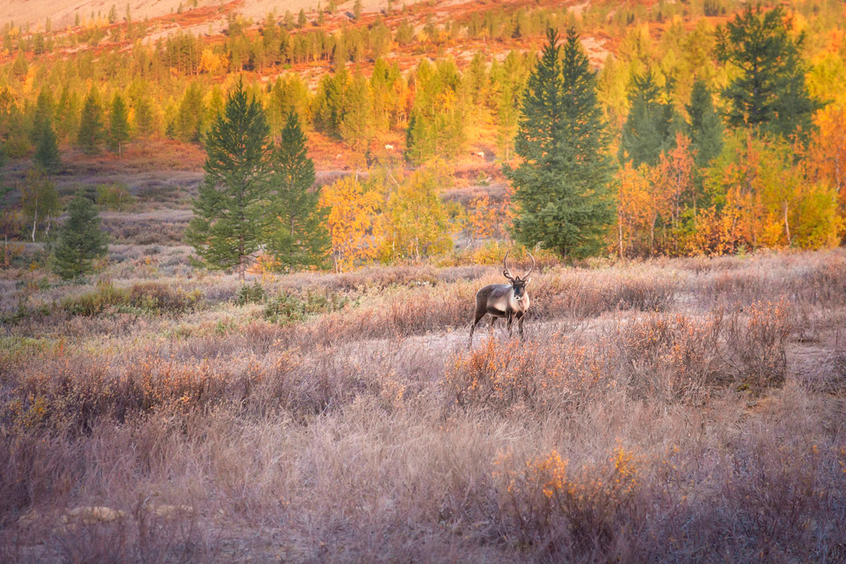
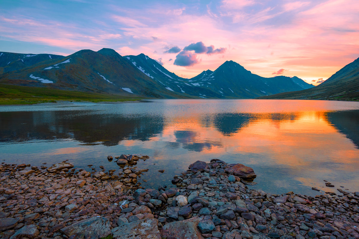
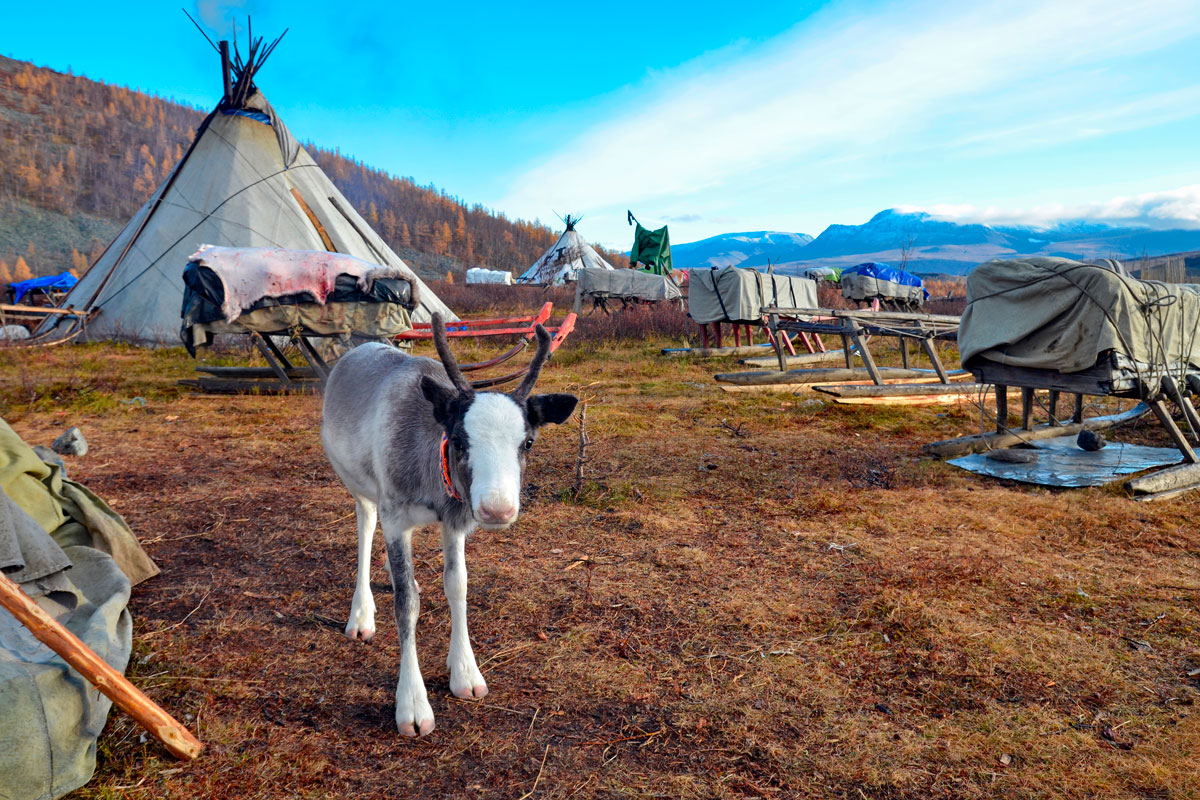
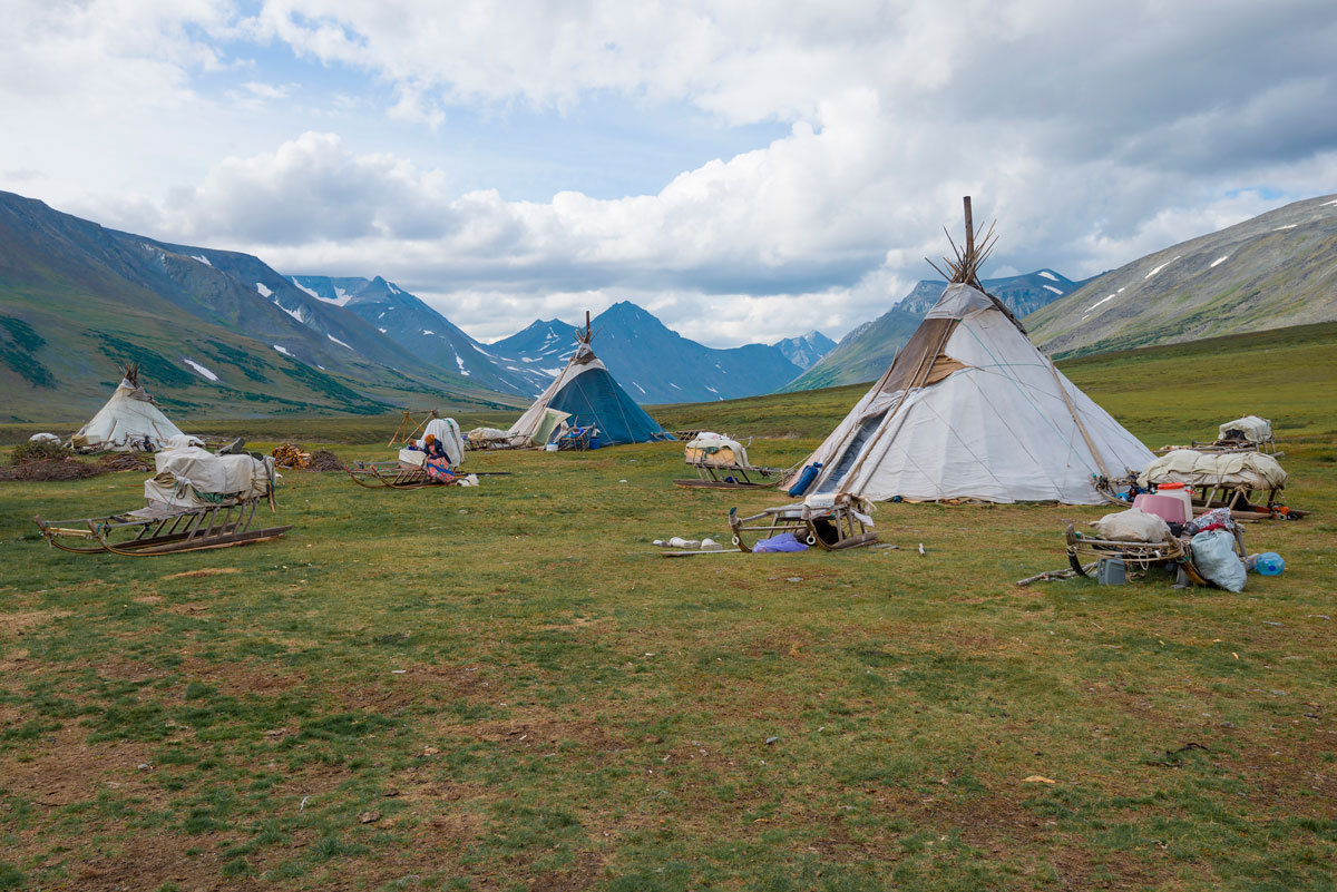
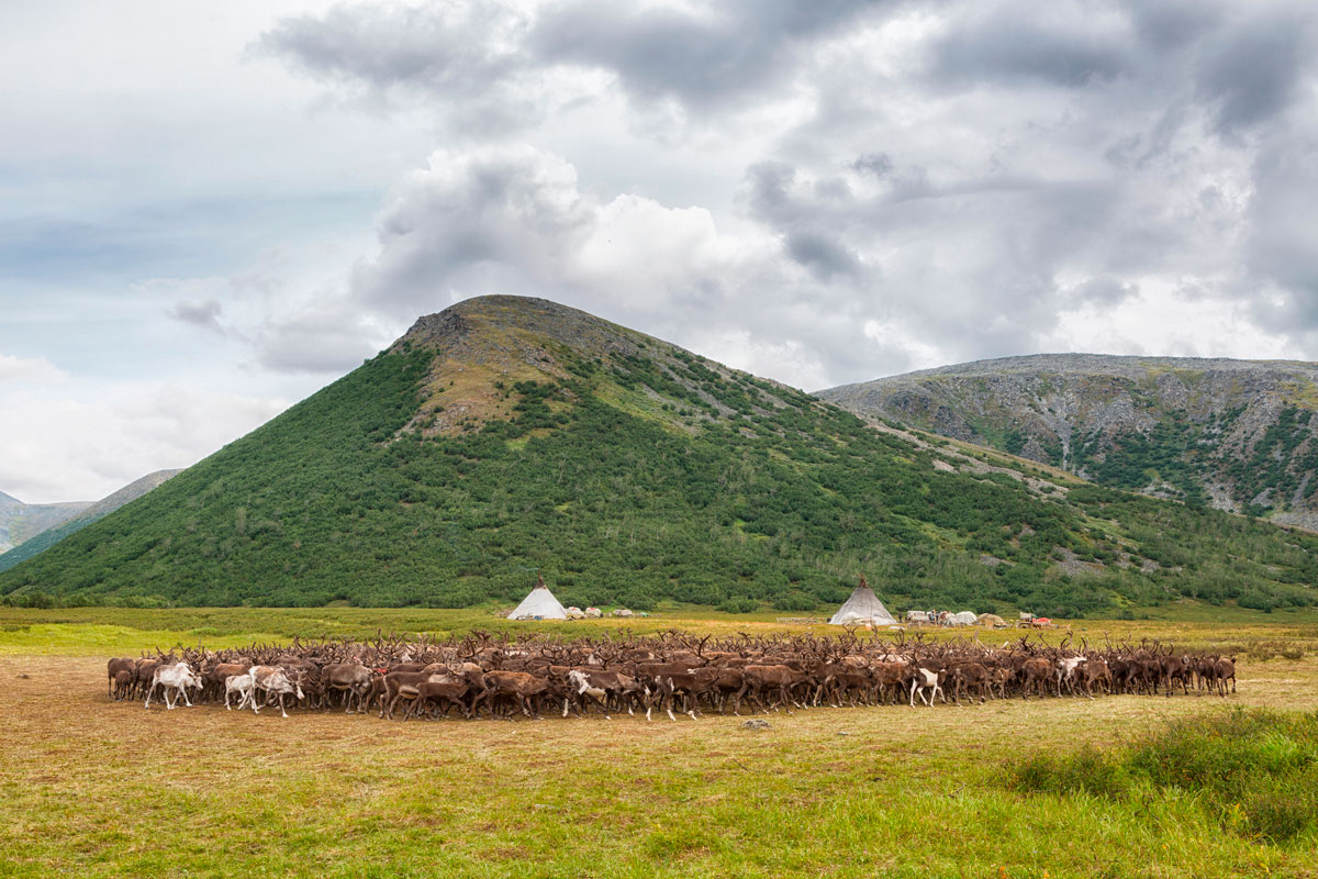
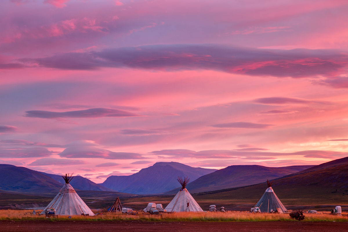
Our journey to the northernmost mountain of the Urals will begin on the Khadata River, near Lake Bolshoe Khadatayongalor, where we will climb one of the highest mountains in this region - Kharnaurdykeu, and see the largest glacier in the Polar Urals - IGAN; we will visit the easternmost point of Europe; we will walk along the valleys of many rivers and the shores of picturesque lakes, including the largest lake in the Ural Mountains by volume of water, and the largest lake in Yamal - Bolshoe Shchuchye Lake; there is a high probability that we will meet reindeer herders who traditionally roam with their herds in these places; picturesque views from the passes, endless tundra and the endless charm of the north await us.
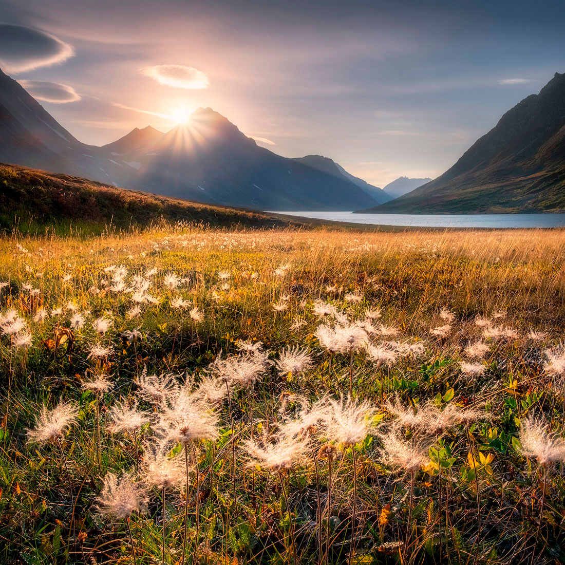
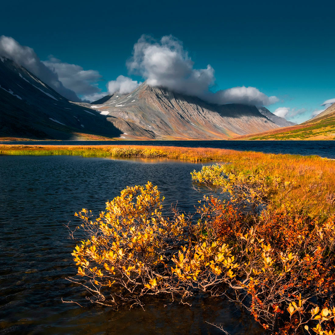
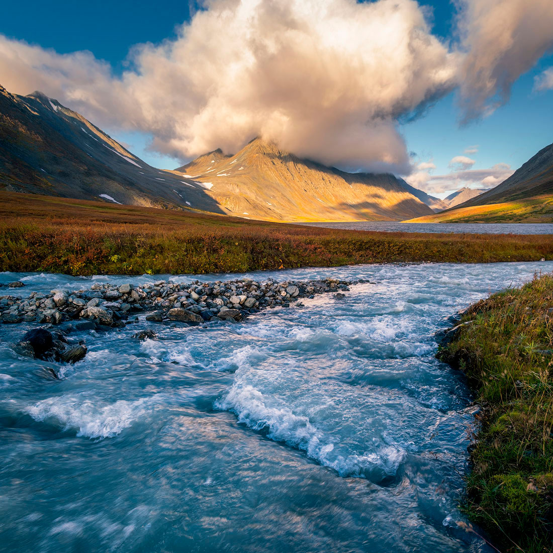
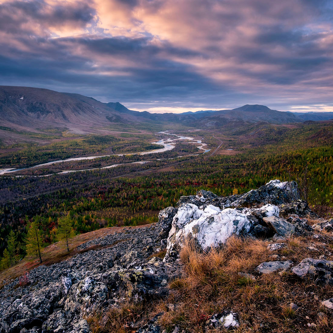
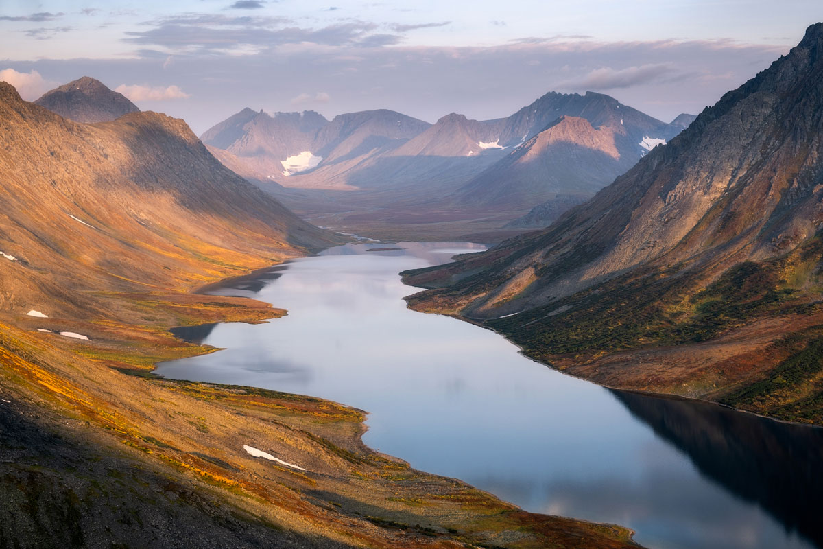
The beauty of the locations of our hike in the Polar Urals through the eyes of photographer Sergey Sutkovy:

VICTORIA SHATALOVA
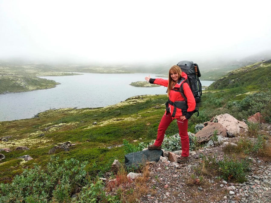
Professional traveler, organizer of author's tours with 16 years of experience. Has visited 37 countries of the world and 82 regions of Russia. Participant and organizer of many hikes, rafting and climbing trips, including climbing the highest and most dangerous volcano in Eurasia - Klyuchevskaya Sopka (4850 m), skiing trips in the northern and polar Urals, Murmansk region and Kuznetsk Alatau.... Read more
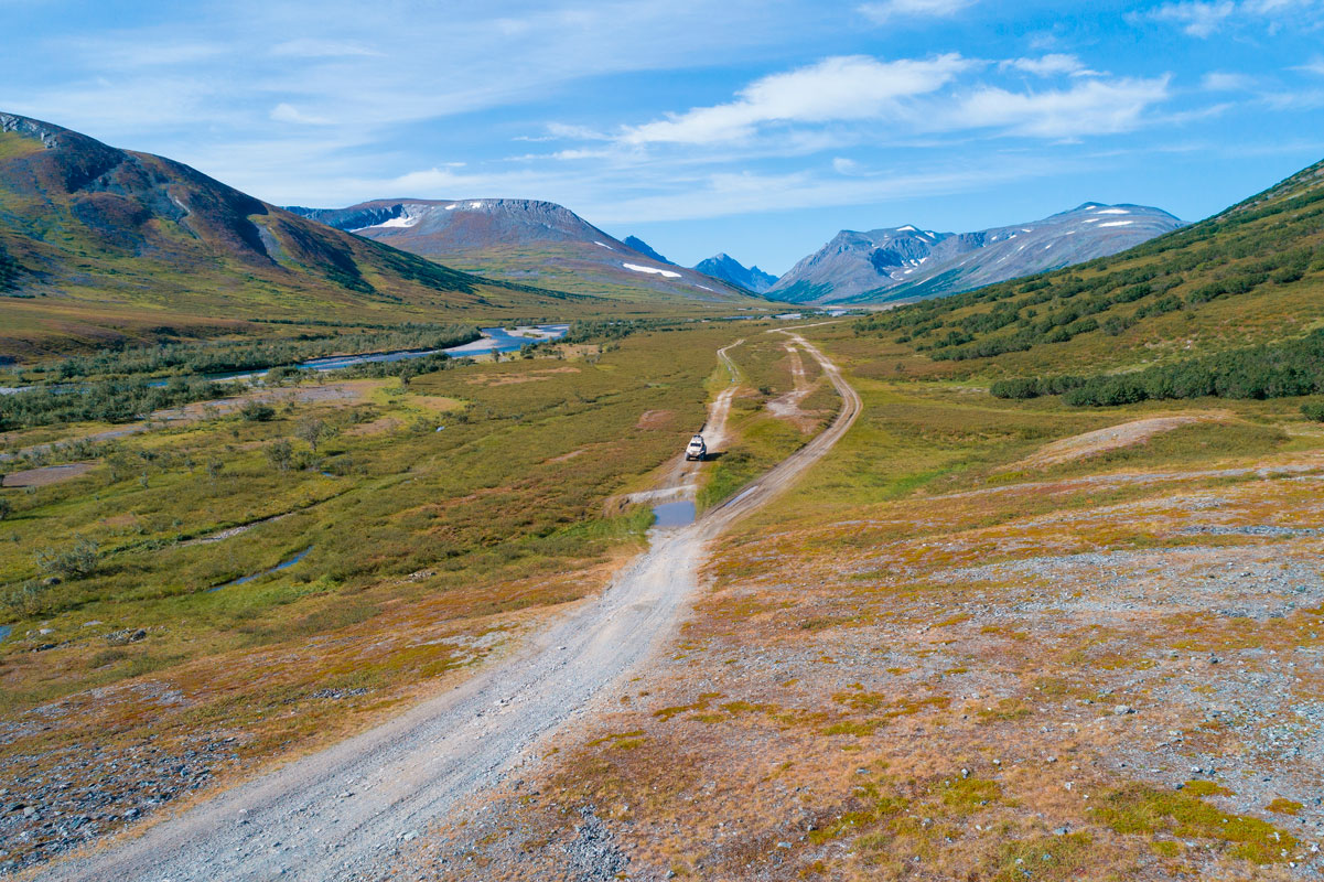
Labitnangi - Bolshaya Khadata River
We meet at the Labytnangi train station at 10.30 a.m. An all-terrain vehicle will take us to the Bolshaya Khadata River. The journey will take about 8 hours. Upon arrival, we will set up camp on the river bank near Lake Bolshoe Khadatayongalor. This lake, connected by a small isthmus to Lake Maloe Khadatayongalor, is located at the foot of the Izyakhoy Ridge. This area is home to the highest and most beautiful mountains in the northern Polar Urals, which rise picturesquely against the backdrop of the lakes. We will go to one of these beautiful mountains, Kharnaurdykeu, the next day.

Bolshaya Khadata River - Big Khadatayongalor Lake - IGAN Glacier - Kharnaurdykeu Peak
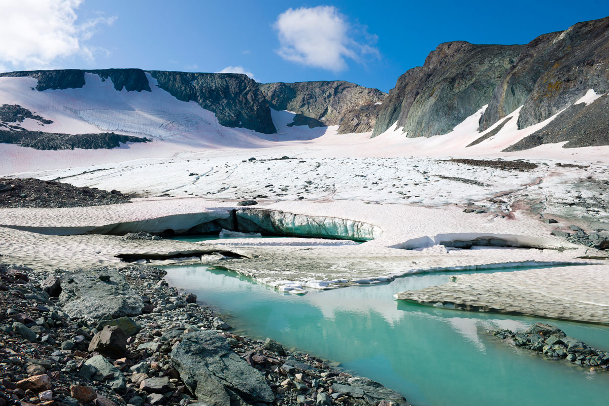
Radial hike to Mount Kharnaurdykeu (1246 m), one of the highest for many kilometers around. On the eastern slope of Mount Kharnaurdykeu is the largest glacier in the Polar Urals - IGAN, which we will see along the way. Mount Kharnaurdykeu offers magnificent views of the Izyakhoy Range and Lake Khadatayongalor. The length of the path to the summit is about 8 km, the altitude gain is 1000 m. Accordingly, in a day we will walk 16 km (to the summit and back to the camp).
Valley of the Bolshaya Khadata River – Valley of the Vorgashor River – Valley of the Ngodayakha River
Early in the morning we pack up the camp and set off on a journey that will first pass along the Bolshaya Khadata River, then along the valley of the Vorgashor and Ngodayakha Rivers. In these places there is a high probability of meeting reindeer herders, who traditionally drive their herds here, usually reindeer herders are friendly to tourists, which gives a chance to get to know their way of life better. We will walk about 17 km. We will stop for the night in the valley of the Ngodayakha River.
Ngodyakha River Valley – Ngodyakha Mountain (the easternmost point of Europe) – Maloye Shchuchye Lake
We are heading through the tundra to the easternmost point of Europe. In 2017, scientists from the Institute of Geography of the Russian Academy of Sciences determined that the easternmost point of Europe is located in Yamal, in the Polar Ural Mountains, on the summit of Ngodyakha (mountain height 793 m). In 2019, a memorial sign in the form of a column with a double-headed eagle was erected here. Having visited this iconic place, we head to Maloye Shchuchye Lake, on the shore of which we will stop for the night. We will cover about 17 km per day.
Lake Maloe Shchuchye - Nudya River Valley - Pyryatane - Gerausvayu River Valley
Today we will walk along Maloe Shchuchye Lake, enjoying the panorama of one of the most beautiful lakes of the Polar Urals, by the way, it is not that small - its length is about 7 km, and it is called small in comparison with Bolshoe Shchuchye Lake, which we will get to know a little later. Walking along the shore of Maloe Shchuchye Lake, we will reach the Nudya River Valley - Pyryatane, and then cross into the Gerausvayu River Valley, where we will set up camp. We will walk about 17 km in a day.
Gerausvayu River Valley - Nenzayakha River Valley - Bolshoe Shchuchye Lake - Pyryatane River Valley
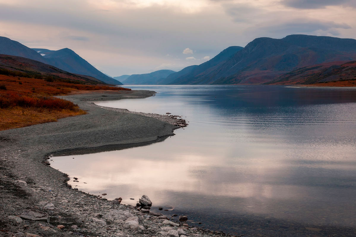
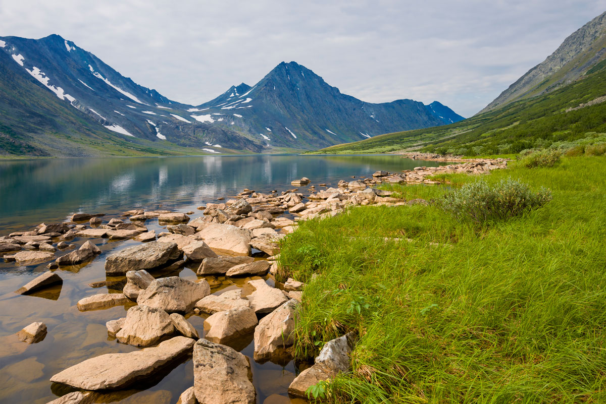
We continue moving along the valleys of the Gerausvayu and Nenzayakha Rivers, overcoming the pass along the way. Today our goal is to walk about 10 km and reach the Pyryatane River valley near the place where it flows into Bolshoe Shchuchye Lake. Bolshoe Shchuchye Lake is the largest lake in the Ural Mountains by volume of water, and the largest lake in Yamal, its length is 13 km, it is also one of the deepest mountain lakes in Russia. The rocky slopes of the ridges (up to 1000 m high) descend steeply to the lake, and in some places the banks drop almost vertically into the water. The bottom of the lake is a stone placer, similar to the stone placers covering the slopes of the banks. For its impressive size and high transparency of water (up to 8 m), Big Shchuchye Lake is sometimes called Yamal Baikal. We will see Lake Shchuchye from the north, having climbed one of the mountains towering over the Pyryatane River valley, not far from the pass through which we will reach the river. We will also spend the night in the Pyryatane Valley, so if we wish, we can walk lightly to see the lake closer.
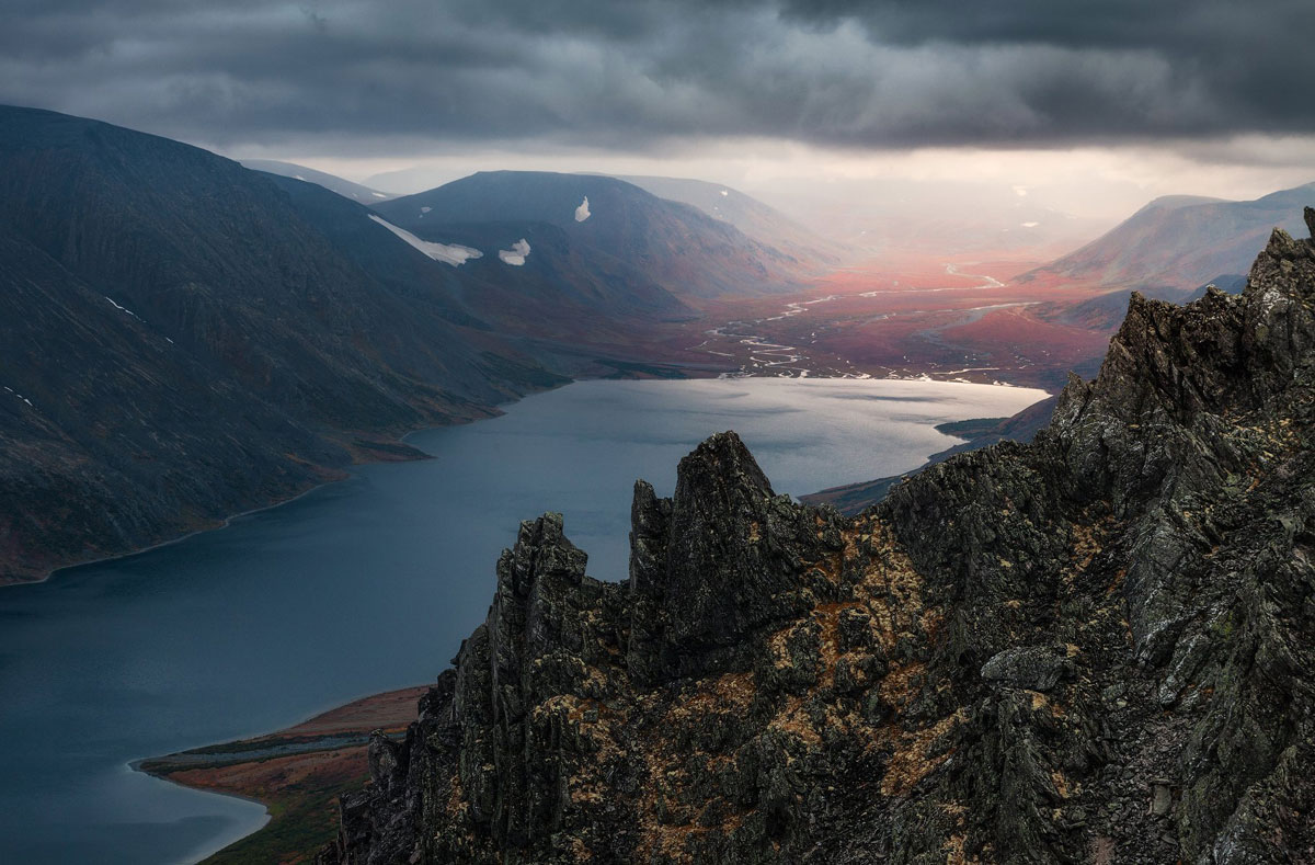
Bolshoe Shchuchye Lake. Photo by Sergey Sutkovoy
Pyryatane River Valley - Bolshaya Kara River Valley
Our path will continue first along the Pyryatane River Valley, then we will climb one of the mountains, about 700 m high, to enjoy on one side the view of the path we have just covered - the Pyryatane River Valley and Lake Shchuchye, and on the other - the view of the Ochenyrd Ridge headed by the highest peak of the entire region - Mount Ngetenape, 1338.2 m high. After admiring the views, we will go down to the Bolshaya Kara River Valley, where we will stop for the night. We will walk about 15 km per day.
Valley of the Bolshaya Kara River - Lake Tisnezato - the Nyarmayakha River
A difficult part of the route awaits us, having forded the Bolshaya Kara River, we will walk along the marshy, willow-covered shore of Lake Tisnezato, and then ford the wide bed of the Nyarmayakha River, on the bank of which we will set up camp. The route for the day will be about 17 km.
Nyarmayakha River Valley – Pass to Ngysyhyyakha River Valley
Our path lies to the pass connecting the Nyarmayakha River Valley with the Ngysyhyyakha River Valley. From the pass we will enjoy the picturesque views of the Polar Ural Mountains, which will be left behind. There will be no high mountains ahead. The last kilometers of the Urals await us, where with each step the mountains become lower and lower, to disappear, turning into endless tundra. We will spend the night at the pass with this picturesque view, having walked about 10 km.
Valley of the Bolshaya Khuta River – Mount Bolshaya Khudyalakhape
We descend into the valley of the Bolshaya Khuta River and head through a swampy valley to Mount Bolshaya Khudyalakhape. The height of this mountain is not great, only 686.6 m, but it offers a view for many kilometers ahead. We will climb it to inspect the surroundings and, in particular, finally see the goal of our route - Konstantinov Kamen. It is still more than 30 km away, but from the mountain it is already visible in the distance. In the foreground rises the peak of Bolshaya Manyasey - we will go to it tomorrow, but for now we will spend the night not far from Bolshaya Khudyalakhape. In a day we will walk about 11 km.
Mount Bolshaya Khudyalakhape - Mount Bolshoy Manyasey - Lake Manyaseyto
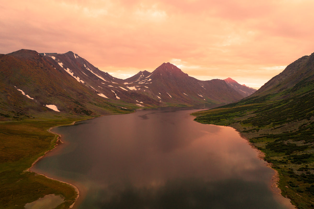
We will go along a narrow low ridge, stretching from Bolshaya Khudyalakhape to Bolshoy Manyasey, to avoid heavily swamped areas. This ridge is the only elevation in the middle of the endless tundra, here the Urals already come to naught, and we are moving forward to its northernmost peaks. The day promises to be long, we will have to cover about 25 km (the longest transition of the entire hike) to find ourselves at the foot of Mount Bolshoy Manyasey, its height is 653 m, and it is the highest mountain of the ridge along which we will go. Of course, you can stop for the night a little earlier, but it seems very attractive to set up camp in a beautiful and mysterious place, on the shore of the sacred Lake Manyaseyto, located between some of the northernmost mountains of the Urals: Bolshoy and Maly Manyasey. Mount Maly Manyasey has a beautiful pyramidal shape and is a cult mountain for the Nenets.
Lake Manyaseito - Mount Maly Manyasey - Konstantinov Kamen
If you wish and the weather is good, we will start the day by climbing Mount Maly Manyasey (525 m high), which offers picturesque views of the surrounding area, including Mount Konstantinov Kamen. Then we will continue our route and finally reach the cherished goal of our journey - the northernmost peak of the Ural Mountains. Further on - only tundra, and 45 km away - the Kara Sea. Of course, we will climb Konstantinov Kamen to inspect the surrounding area and record our success in a photo. We will walk about 9 km per day. We will spend the night right here at the foot of Konstantinov Kamen.
Spare day
Spare day in case of severe weather and other unforeseen circumstances.
To civilization!
About 2 km from Konstantinov Kamen mountain there is a road along which we will travel by transport 165 km to Vorkuta to return to civilization.
Hike to Jack London Lake
a difficult but very beautiful hike along Kolyma
August 28 - September 9, 2025Complexity:
Charsky Sands and Kodarsky Ridge
Hiking in Eastern Siberia
September 19 - 28, 2025Complexity:
Hiking in Ingushetia at the most beautiful time of the year
a simple but beautiful hike for lovers of the Caucasus nature
18 - 26 October 2025Complexity: