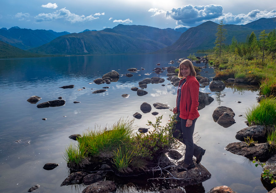
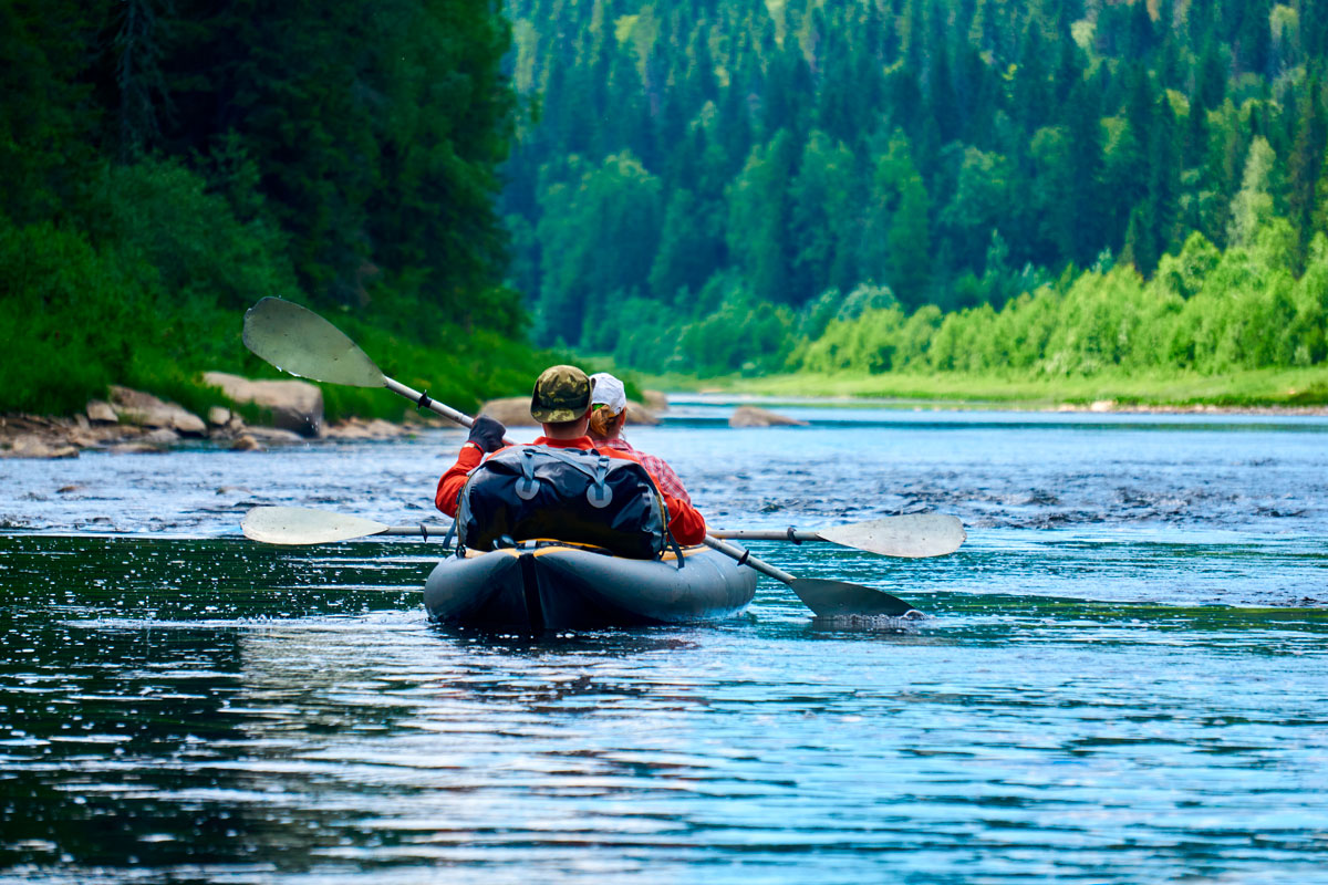
Kayaking on the Chusovaya River
from Ust-Utka to the city of Chusovoy
Travel dates: May 18–29, 2027
Travel organizer:
VICTORIA SHATALOVA
A professional traveler and organizer of original trips with 16 years of experience. She has visited 40 countries around the world and 82 regions of Russia. Participant and organizer of numerous road trips, hikes, rafting trips and ascents, including ascents of Kilimanjaro (5895 m) and Elbrus from the east (5624 m), the highest and most dangerous volcano in Eurasia - Klyuchevskaya Sopka (4850 m), summer and winter ski trips in the Northern, Subpolar and Polar Urals, the Murmansk region and the Kuznetsk Alatau.... Learn more
Itinerary day by day:
Ust-Utka - Kharenki
We'll meet in Yekaterinburg in the morning and transfer to the village of Ust-Utka, the starting point of our rafting trip. The journey will take about three hours. Upon arrival in Ust-Utka, we'll have a snack and stroll through the village, which was the first Russian settlement in what is now the Sverdlovsk Oblast. Ust-Utka was founded at the confluence of the Mezhevaya Utka River and the Chusovaya River in 1574. Among the village's attractions are the remains of a pier built in the 1760s and 1770s, which immediately became the largest private pier on the Chusovaya River, a monument to the "Unity of Russia," and the private Yesenin Museum, a rock garden with the poet's poems carved into them.
After exploring the village, we begin our rafting trip. On the first day, we'll walk a short distance and set up camp near the village of Kharenki. The village is interesting because a monument to Akinfiy Demidov stands on an island in the Chusovaya River.
We'll travel 210 km by car and walk 7 km along the river.
Kharenki - Omutnoy Rock - Dyrovaty Rock - Vogulinskaya Mountain - Yokva - Sobachy Rocks
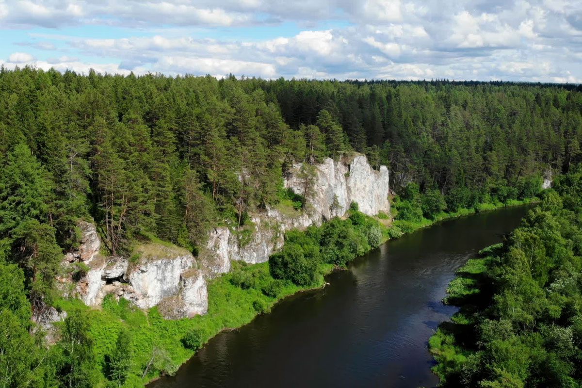
After breakfast, we continue our rafting. Today we'll see Omutnoy Rock, one of the most famous and beautiful rocks on the Chusovaya River. Omutnoy Rock is often called the river's calling card, as it is depicted more often than others in paintings and photographs of the Chusovaya. The rock is approximately 70 meters high, with an observation deck at the top, which we'll climb to enjoy the views. The shore opposite Omutnoy Rock is sandy, where we'll stop for a snack. Beyond Omutnoy Rock, you'll notice Zubets Rock and the Burkay Rocks, which are spurs of Omutnoy Rock. The next interesting rock is Dyrovaty Rock, which stretches along the river for more than a kilometer. It reaches a height of 82 meters. Among the attractions of Dyrovaty Rock are the Tourists' Cave and a sanctuary, which, according to archaeologists, dates back to the Mesolithic era. Passing Vogulinskaya Mountain, whose name comes from the Vogul-Mansi people, we'll reach the village of Yokva, an 18th-century settlement now a dacha community. Beyond the village, the Sobachy Kamni rock formation stretches for about 3 km. After traversing it completely or partially, we'll set up camp for the night.
We'll travel 18 km along the river in one day.
Permyakovo - Pisanny Stone - Stolby Massif - Samarinsky Stone - Duzhnoy Stone - Novikov Stone
Today we'll pass by the former village of Permyakovo, beyond which we'll see the Pisanny Stone. It's called so for a reason: the stone bears an inscription and a cross, carved in the 18th century. The inscription tells of the birth of Nikita Akinfievich Demidov on the opposite bank of the river on September 8, 1724. The inscription is carved quite high and inaccessible without special equipment, but lower down, directly above the river, is a much more modern inscription from the mid-20th century. Imitating the Demidovs, this inscription contains the biography of a resident of the now-defunct village of Permyakovo. On the left bank, opposite the Pisanny Stone, stands the Demidov Cross, carved from a single stone. The cross was erected in 1779 and bears the same inscription as the one on the rock. Next, we'll reach the Stolby massif—a series of beautiful, diversely shaped cliffs up to 50 meters high, interrupted by dense, overgrown forest and ravines for a kilometer. Near Samarinsky Rock, we'll cross the border of the Sverdlovsk Region and enter the Perm Krai. However, the Chusovaya River will later return to the Sverdlovsk Region for a while.
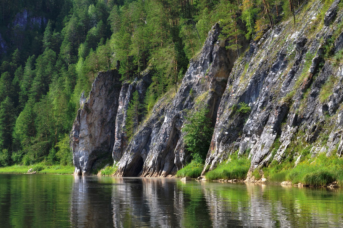
Another interesting natural landmark is Duzhnoy Rock, consisting of several ridges up to 60 meters high, composed of arcuate layers reflecting tectonic processes that occurred millions of years ago. We'll end the day near Novikov Rock. This rock is interesting because it contains a through cave, over which rises a beautiful 8-meter-high arch about 20 meters wide.
We'll travel 23 km along the river this day.
Kotel Rock – Rostun Rock – Yurt Rock – Yellow Rock – Kirpichny Rock – Giant Rock
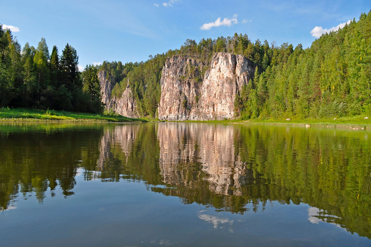
We'll follow a sharp, 5-kilometer-long bend in the river. The arc begins at Kotel Rock and describes an almost complete circle: a little over half a kilometer in a straight line from one side of the bend to the other. Along the way, we'll see Rostun Rock, 96 meters high, the second tallest rock on the Chusovaya River. Beyond Rostun Rock, the Serebryanka River flows into the Chusovaya, and beyond that rises Rudnikovaya Mountain, named for the mines that once stood here. Rocky outcrops can be seen here and there through the forest. Next, we'll pass Yurt Rock, named for its shape, and Yellow Rock, so named because the lichens growing on it give it a yellowish tint. Then we'll encounter an unusually tall rock – Kirpichny Rock. The numerous cracks in the stone's structure make it appear as if it were made of brick.
We'll set up camp for the night near Velikan Rock, the tallest rock on the Chusovaya River. It stands 120 meters tall. Velikan Rock is famous not only for its height but also for its length, stretching along the right bank of the Chusovaya River like a huge sheer wall for approximately 2 kilometers. Incidentally, the deepest pool on the river is located near Velikan Rock.
We'll travel 21 km along the river in one day.
Kyn Village - Stenovoy Kamen - Ostryak Kamen
Today we'll approach the village of Kyn, where we'll stop to explore its sights. In the 1760s, the Stroganovs created a pond and built an ironworks on the Kyn River. Several mines were also located here. Nothing remains of the ironworks today, but you can still see the remains of the pier. Of particular interest is the Holy Trinity Church, built in the village between 1861 and 1864 to commemorate the abolition of serfdom. The village's local history museum features an exhibit covering the history of Kyn and its surrounding area, as well as the history of the local ironworks, which was once the industrial heart of the region. A monument, "The Beginning of the Perm Region," was erected in the village, as the oldest examples of jewelry in the Perm animal style were found here. There's another monument in the village—the "Iron Caravan Monument," a larger-scale replica of the lead used by rafters to slow barges in the most dangerous spots.
After exploring the sights of Kyn village, we continue onward. Along the way, we'll see the majestic Stenovoy Stone, and we'll stop for the night near Ostryak Stone. Ostryak Stone marks the end of the limestone strip on the Chusovaya River, and marks the beginning of older rocks composed of dark brown sandstone.
We'll travel 11 km along the river in one day.
Babensky Reach – Krovyanoy Bereg – Verkhnyaya Oslyanka – Nizhnyaya Oslyanka – Sterlyazhiy Stone
We enter the long Babensky Reach. For about 7-8 kilometers, we won't encounter any rocks. Then we reach a place called Krovyanoy Bereg – a dark maroon sandstone outcrop. We'll pass the once-large village of Verkhnyaya Oslyanka, opposite which stands the Oslyansky Stone. Like other nearby stones, it is composed of ancient sandstones from the Devonian period, giving it a dark color. Herons often nest on the rock.
We'll pass another very small village, Nizhnyaya Oslyanka, beyond which we'll encounter several small rocks, the most notable of which is Sterlyazhiy Rock. Beneath the rock is a deep pool, and on the rock is an interesting "curl" of rock—an anticlinal fold (a convex curve of successively layered rocks). Beyond the rock begins the Sterlyazhiy Reach, and in the 19th century, the village of Sterlyazhie was located below the rock. We'll set up camp in this area for the night.
We'll travel 20 km along the river in one day.
Ruins of the Konovalovsky Woodworking Plant - the Sylvitsa River - Ermak Rock - Kotel Rock - Bat Cave
Passing the now-defunct villages of Kopchik and Lugovaya, we arrive at the ruins of the Konovalovsky Woodworking Plant from the early 20th century. Construction of this large plant, large for its time, began in 1915, and much of the structure was completed in just a year. However, in the fall of 1916, by government order, all work was abruptly halted. The walls, foundations, and underground structures remain. The best-preserved structures are the bridge piers, which were intended to support the narrow-gauge railway.
After exploring the ruins of the plant, we continue on our way. We pass the mouth of the Sylvitsa River, beyond which the light-colored limestone cliffs familiar to the Chusovaya River begin again, the most noticeable of which is Ermak Rock. The rock contains a small grotto, as well as a cave named Ermakova. The cave is located at a considerable height and is inaccessible without special equipment, but it is clearly visible from the river. There are many legends associated with Ermak's residence in this cave, which are most likely untrue.
Then we will reach the Kotel (Cauldron) rock (this is the second rock on the Chusovaya River with this name). The rock consists of several rocky outcrops, the last of which contains the interesting Bat Cave. It is a large grotto with a gradually narrowing passage over 10 meters long. Bat Cave is an archaeological site. Scientists have discovered an ancient sanctuary there. Many finds in the cave have been dated to the Paleolithic era.
We will walk 19 km along the river in one day.
Chizma - Ostry Rock - Ust-Bedka - Ust-Kumysh
Our route will take us past a series of small rocks: Temnyash, Maly and Bolshoy Strelnye, Svadebny, Veer, and Pechka. After the former village of Chizma, we'll reach Ostry Rock, so named for its sharp, sloping edge, jutting out like a stone blade. Below the rock, on the left bank, lies a long island, stretching for almost a kilometer. Further on, we'll pass the former settlement of Ust-Bedka, a special settlement for settlers. The settlement arose in the 1930s and disappeared in the 1960s. A single-house outpost now stands in its place. Immediately beyond the outpost, along the right bank, rises Mount Krugly Mys. The Chusovaya River makes a large 180-degree bend here. We'll stop for the night in a clearing on the site of the former large village of Ust-Kumysh.
We'll travel 24 km along the river in one day.
Four Brothers Rock - Otmetysh Rock - Rassolnaya River
We're walking along a winding section of the river. The rocks in this area of the Chusovaya River were dangerous for barges during shipping times due to the river's sharp turns. Razboinik Rock was considered particularly dangerous; in 1877, 23 barges were wrecked on it in one day, killing over 100 people.
Of interest is the Four Brothers Rock, or, according to other versions, the Five Brothers. This beautiful rock consists of several cliffs jutting out toward the river. Depending on your perspective, the number of "brothers" varies from two to five.
Otmetysh Rock is also of interest. It's a beautiful and fairly tall rock. It consists of two cliffs, each reaching a height of 50 meters. In the past, the rock jutted out significantly further into the river, but one day, the overhanging section of the rock unexpectedly collapsed.
Today we'll reach the Rassolnaya River. There used to be a village here, complete with a small pier and shipyard. We'll set up camp near the former village.
We'll travel 22 km along the river in one day.
Dyrovatyye Rebra Stone - Ust-Koyva - Red Stone - ruins of the Stvor camp - Plakun Stone - Shaitan Stone
We'll pass the interesting Dyrovaty Ribs rock. Here lies the largest arch on the Chusovaya, the Tsar's Gate, clearly visible from the river. Further on, we'll stop for a short break in the village of Ust-Koiva. A few hundred meters from Ust-Koiva lies the Red Stone, which you can climb for stunning views. We'll pass the mouth of the Ponysh River, opposite which lies one of the largest grottoes on the Chusovaya, the Teatralny Grotto. Beyond the picturesque Pechka rock, we'll see the remains of the former political prison camp "Stvor." This is one of the longest-existing prison camps on the Chusovaya River and the only camp in the Perm region with penal status. From 1942 to 1948, it was part of the Ponyshsky Correctional Labor Camp. Prisoners from Stvor carried out preparatory work for the construction of the Ponyshskaya Hydroelectric Power Plant here on the Chusovaya River. From 1946 to 1962, the camp was designated "for forced labor," subjecting prisoners to the harshest and most brutal conditions. From 1962 to 1972, a special camp settlement existed here. Currently, the Perm youth movement has created a "museum without a guide" on the site of the camp. After exploring the remains of the camp, we'll pass by Plakun Rock, a rock composed of reef limestone, named for the water that seeps down its walls in places. Beyond the next rock, Shaitan Rock, three successive rock outcrops, we'll choose a place to spend the night.
We'll walk 24 km along the river in one day.
Blue Lake – Chusovoy
Today we will arrive in Chusovoy. Along the way, we will stop by Blue Lake, located on the right bank of the Chusovaya River, a few dozen meters from the river. Divers exploring the lake discovered a downward-sloping karst cavity at the bottom, through which an underground river flows. The underwater cave reaches a depth of 56 meters and then changes direction to horizontal. This makes Blue Lake the deepest underwater cave in the Perm region.
In Chusovoy, the rafting portion of our journey concludes. We pack up our kayaks, check into a hotel or hostel, and then head off on an excursion to the open-air museum "Chusovaya River History Park."
We will spend the night at the hostel.
We will travel 14 km along the river this day.
Home
We're heading home. From Chusovoy, you can take a train to Perm (about 2.5 hours), Yekaterinburg (7-8 hours), and Moscow (about a day's travel time).